Car GPS has become a quiet hero of everyday driving. It guides us through traffic, helps us avoid wrong turns, and even recalculates routes when we miss an exit. Yet most drivers use GPS navigation daily without really knowing how it works.
Understanding how a car GPS system works is not just about curiosity. It helps you trust the directions, understand its limits, and troubleshoot common problems when navigation fails. This guide explains the entire process in simple language, without technical confusion, while still being accurate and useful.
“Good navigation does not just tell you where to go. It tells you where you are.”
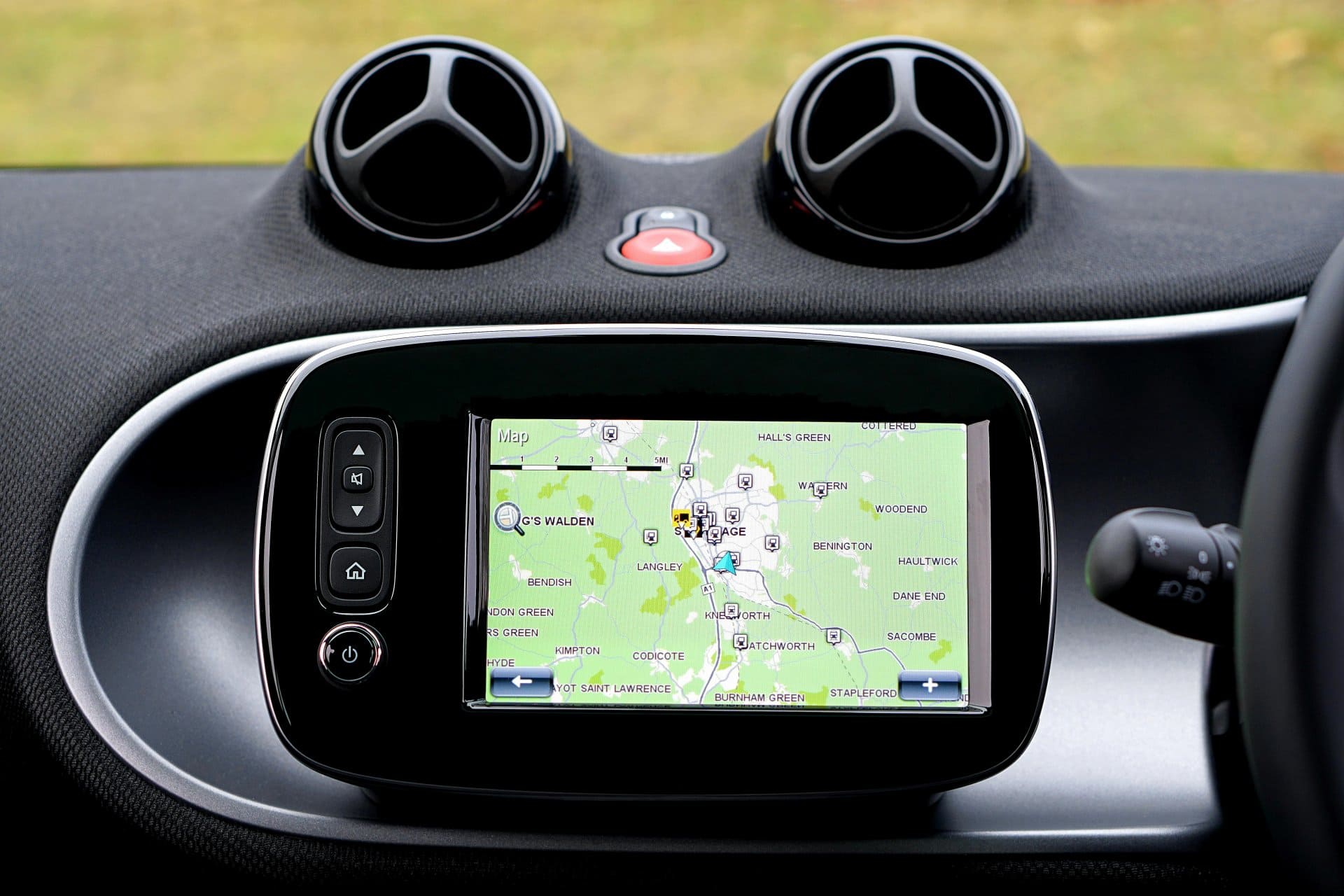
What Is a Car GPS?
A car GPS (Global Positioning System) is a navigation system that helps a vehicle determine its exact location on Earth and guide the driver to a destination using digital maps.
In simple terms, a car GPS answers three basic questions:
- Where am I right now?
- Where do I want to go?
- Which route should I take to get there?
Modern GPS systems can be found in:
- Built-in car navigation systems
- Infotainment screens
- Android Auto and Apple CarPlay setups
- Dedicated GPS devices
Even though smartphones also use GPS, car GPS systems are designed for driving conditions, larger displays, and vehicle-based accuracy.
Most owners of large fleets of cars or trucks will know more about the usefulness of these GPS tracking devices. You are easily able track your vehicles and literally know their location 24/7, and also it’s quite useful if your vehicle has one, for the purposes of reimbursement for trips and assists with distance travelled for bookkeeping.
The Basic Idea Behind GPS (In Simple Words)
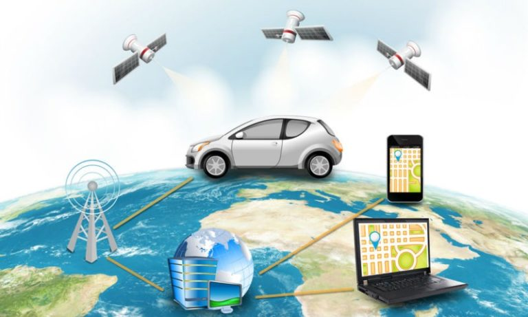
At its core, GPS works using satellites in space and a receiver inside your car.
Here’s the simplest way to understand it:
- Satellites send signals to Earth
- Your car’s GPS receiver listens to those signals
- It calculates how far away each satellite is
- Using that data, it figures out your exact position
This process happens continuously while you drive.
GPS Satellites: The Backbone of the System
GPS depends on a network of satellites orbiting the Earth. These satellites constantly send signals that include:
- Their exact position in space
- The exact time the signal was sent
Your car’s navigation system does not send signals back. It only receives them.
Why Satellites Matter
To calculate location accurately, your GPS receiver usually needs signals from at least four satellites:
- Three satellites determine position (latitude and longitude)
- One satellite corrects time errors
More satellites mean better accuracy.
How Your Car Knows Its Exact Location
This is where the real magic happens, but it’s easier than it sounds.
Step-by-Step Location Calculation
- The satellite sends a signal with a timestamp
- Your car’s GPS receives that signal
- The system calculates how long the signal took to arrive
- Distance is calculated using signal travel time
- The process is repeated with multiple satellites
- Your exact location is calculated using triangulation
This happens in seconds and updates constantly as you drive.
What Is Triangulation in GPS?
Triangulation is the method used to pinpoint your position.
Imagine standing somewhere and knowing:
- You are 10 miles from satellite A
- 12 miles from satellite B
- 15 miles from satellite C
There is only one spot on Earth where all three distances match. That spot is your location.
This is how GPS pinpoints your car’s position on the map.
GPS Maps: The Digital Road Guide
Knowing your location is only half the job. GPS also needs maps to guide you.
What GPS Maps Contain
- Roads and highways
- Street names
- Speed limits
- Intersections and exits
- Landmarks and points of interest
These maps are stored:
- Inside the car system (offline maps)
- Or updated through internet connection
Navigation works best when maps are up to date.
How GPS Chooses the Best Route
Once you enter a destination, the system:
- Looks at available roads
- Calculates distance and travel time
- Considers speed limits and road types
- Chooses the fastest or shortest route
Many systems also consider:
- Traffic congestion
- Road closures
- Accidents
This is why GPS sometimes reroutes you while driving.
Does Car GPS Need the Internet to Work?
This is one of the most common questions.
No, basic GPS does not need the internet.
GPS satellites provide location data without any network connection. However, the internet helps with:
- Live traffic updates
- Faster route recalculation
- Map updates
- Voice search
Without internet, GPS still shows location and directions using stored maps.
Car GPS vs Smartphone GPS: Is There a Difference?
Both use satellite signals, but there are practical differences.
Car GPS Systems
- Designed for driving accuracy
- Larger antennas
- Better visibility on dashboards
- Less battery concern
Smartphone GPS
- Depends on phone battery
- Uses GPS + mobile networks + Wi-Fi
- May lose accuracy in tunnels or dense areas
For long drives, car GPS systems are often more stable.
How Accurate Is a Car GPS?
Under normal conditions, GPS accuracy is usually within:
- 5 to 10 meters
Accuracy can improve with:
- Clear sky view
- More satellite connections
- Updated software and maps
Accuracy can reduce due to:
- Tall buildings
- Tunnels
- Heavy trees
- Bad weather (rare but possible)
Why GPS Sometimes Shows Wrong Location
Common reasons include:
- Weak satellite signal
- Outdated maps
- Software glitches
- Interference from buildings
If your GPS jumps around or shows wrong turns, recalibration or updates often fix the issue.
GPS and Vehicle Sensors Working Together
Modern cars use more than just satellites.
They combine GPS with:
- Speed sensors
- Gyroscope
- Steering angle sensors
This helps maintain accuracy when satellite signals are weak, such as in tunnels or parking garages.
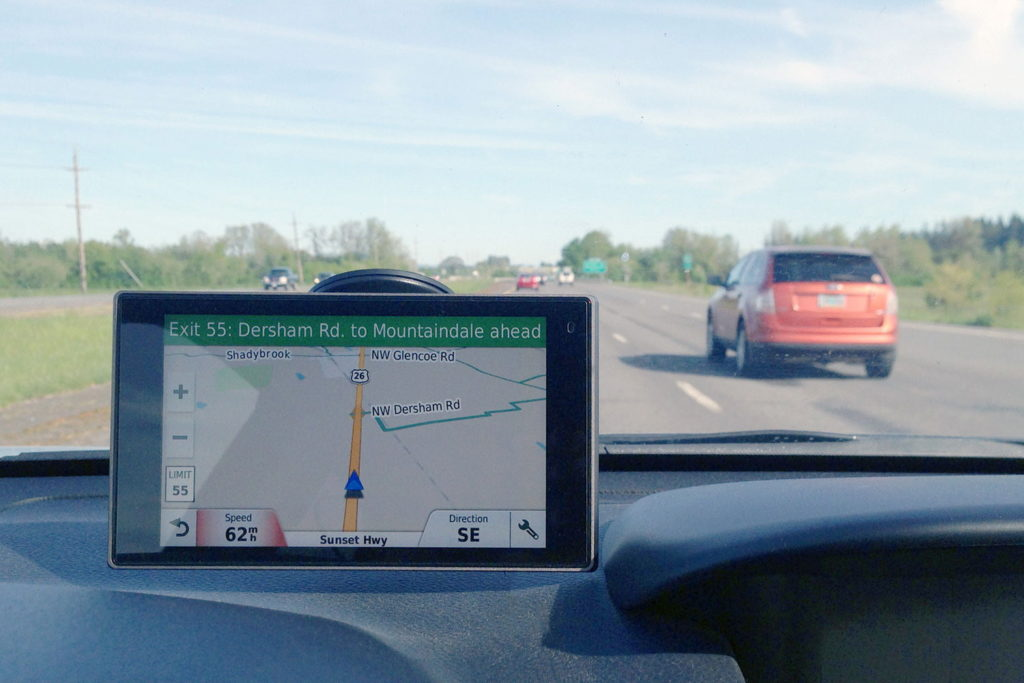
Turn-by-Turn Navigation Explained
Turn-by-turn navigation is the feature that:
- Gives voice instructions
- Shows lane guidance
- Alerts about upcoming turns
It works by constantly comparing:
- Your real-time location
- The planned route
If you miss a turn, the system recalculates instantly.
Real-Life Example of GPS in Action
Imagine driving in a new city:
- You enter your destination
- GPS finds your location
- It chooses the fastest route
- Alerts you before every turn
- Adjusts route when traffic slows
All this happens automatically, without you noticing the complex calculations behind it.
Common GPS Problems and Simple Fixes
GPS Signal Lost
- Move to an open area
- Avoid underground parking
Wrong Directions
- Update maps
- Restart the system
Slow Response
- Clear cache (if possible)
- Update software
Small steps often solve big navigation issues.
Advantages of Car GPS Systems
- Reduces chances of getting lost
- Saves time and fuel
- Improves driving confidence
- Helps in emergencies
- Useful for long-distance travel
For many drivers, GPS is now as important as seatbelts.
Limitations You Should Know
GPS is powerful, but not perfect.
Limitations include:
- Cannot predict sudden roadblocks
- Depends on map accuracy
- Signal issues in rare conditions
The limitation with these GPS trackers is that they’ll require a cell service with good netwok signals to determine real-time location, but nevertheless you can easily keep a track of your vehicle’s location with these GPS trackers. Understanding these limits helps you drive smarter.
The Future of Car GPS Navigation
Modern navigation systems are improving with:
- Better traffic prediction
- Integration with car safety systems
- Smarter voice assistants
- Improved accuracy in cities
Navigation is moving from simple directions to intelligent driving assistance.
Final Thoughts
A car GPS works by combining satellite signals, precise timing, and digital maps to guide you safely to your destination. While the technology behind it is complex, using it is simple—and that’s the beauty of it.
Knowing how GPS works helps you trust it, use it better, and understand its limitations.
“Technology works best when you understand just enough to use it wisely.”
Frequently Asked Questions (FAQs)
1. Does car GPS work without mobile network or Wi-Fi?
Yes. Car GPS works using satellites, not mobile data. Internet is only needed for traffic updates and map downloads.
2. Why does GPS sometimes show the wrong location?
This can happen due to weak satellite signals, tall buildings, tunnels, or outdated maps.
3. How many satellites does a car GPS need to work properly?
A car GPS usually needs signals from at least four satellites for accurate location tracking.
4. Is built-in car GPS better than phone GPS?
Built-in car GPS is more stable for long drives, while phone GPS is more flexible but depends on battery and network support.
5. Can GPS work inside tunnels or parking garages?
GPS signals may weaken in such places. Modern cars use sensors along with GPS to maintain navigation until signals return.
Summary
- GPS uses satellites to find your location
- Your car receives signals, not sends them
- Maps guide you after location is known
- Internet improves features but is not required
- Accuracy depends on environment and updates